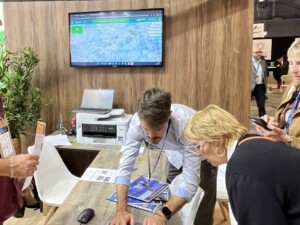
On Wednesday 11 December, a team from the Kenya Space Agency, together with representatives from universities, start-ups and local companies, visited Montpellier as part of a study visit to Europe organised by Aerospace Valley.
The visit is part of a European project led by Expertise France called ‘Data Governance in Africa’, which aims to develop data policies centred on people and development at different scales in several African countries.
Predict Services welcomed this delegation with the aim of sharing and discussing the innovative methods, tools and solutions that have been deployed by local authorities, businesses and citizens for over 20 years in the management of hydrometeorological risks.
These discussions provided food for thought on potential collaborations.
Thunderstorms, intense rainfall, flooding… the events that have impacted our regions in recent months have once again highlighted the need to adapt to climatic risks.
At local level, there are a number of preventive measures in place to help identify and take appropriate action. For over 10 years, Groupama-Predict has been providing day-to-day support to local authorities in drawing up their Plans Communaux de Sauvegarde (PCS) and their DICRIM, and in providing real-time information in the event of risk.
At the Salon des Maires et des Collectivités Locales in Paris from November 19 to 21, Groupama-Predict engineers will be on hand to present the climate risk adaptation solutions included in your local authority insurance policy.

Groupama-Predict stand
Meet us at the Porte de Versailles exhibition center, Hall 2.2 – stand D62.
For more information about the show, click here.
Invited by CNES (Centre National d’Etude Spatial) to the Spatial Climate Observatory Congress on May 30, 2023 at Bercy, Predict presented the Gade Lapli project. This project provides indicators and services using satellite data to estimate rainfall and flood areas. Tested on the highly vulnerable territory of Haiti, the operational objective (warning, crisis management) also serves to understand climate change by identifying and characterizing extreme events.